Rajamangala University of Technology Srivijaya (RUTS), through its Water Management Innovation and Geoinformatics Research Unit, contributed to disaster-risk education and capacity building through two training activities conducted in November and December 2025. These initiatives focused on strengthening knowledge and practical skills in participatory mapping, Geographic Information Systems (GIS), and water-related hazard analysis. By engaging local communities and university students, RUTS promoted the use of geospatial technologies to support disaster preparedness, water-resource planning, and the development of approaches to managing climate-related risks.
RUTS Provides Community Training on Disaster-Risk Mapping and GIS-Based Water Management
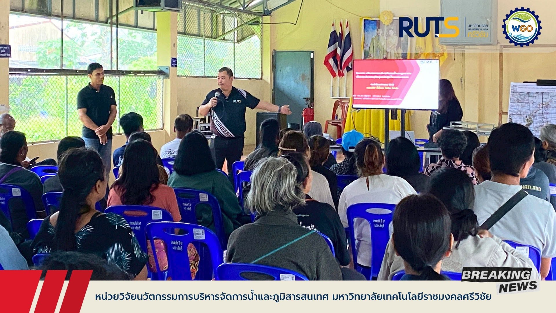
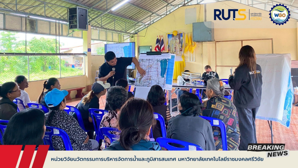
On 19 November 2025, the Water Management Innovation and Geoinformatics Research Unit of Rajamangala University of Technology Srivijaya (RUTS), led by Asst. Prof. Dr. Nattapol Kaewthong and his research team, conducted a community training programme on participatory mapping and Geographic Information Systems (GIS) at the community hall in Ban Khok Ching, Chai Buri Subdistrict, Mueang District, Phatthalung Province.
The training was organised under the research project Integrated Water Management Innovation to Enhance Community Economies in the Songkhla Lake Basin. It aimed to strengthen local capacity to identify disaster-prone areas and use spatial information for water-resource planning and risk reduction. The training addressed local water-related disaster risks, including flooding and drought, and demonstrated how participatory mapping and GIS could support community preparedness and adaptation to climate-related hazards.
Participants engaged in focus-group discussions to identify local water-management challenges and disaster-risk areas. They then worked together to develop hand-drawn community maps and prepare spatial information for conversion into GIS. These activities introduced practical mapping approaches that can support community understanding of local environmental risks and inform future water-management and disaster-prevention planning.
By combining participatory learning with geospatial technology, the programme provided community members and local stakeholders with practical knowledge and tools for identifying vulnerable areas and supporting locally informed water-resource management.
RUTS Researchers Deliver Practical Training on Flood-Risk Analysis and GIS-Based Disaster Management
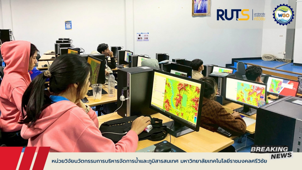
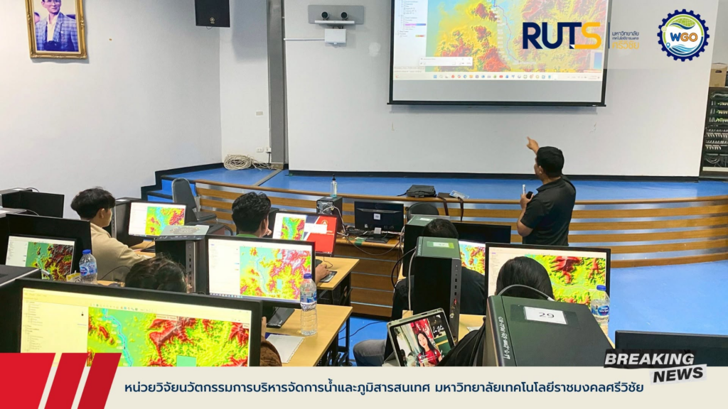
From 1 to 3 December 2025, researchers from the Water Management Innovation and Geoinformatics Research Unit of Rajamangala University of Technology Srivijaya (RUTS), led by Asst. Prof. Dr. Nattapol Kaewthong and Mr. Sarayut Nakrod, served as trainers in a practical workshop under the Sustainable Community Disaster Management Innovation Development Project. The workshop was held at Suratthani Rajabhat University, Surat Thani Province.
The training focused on the application of HEC-RAS (Hydrologic Engineering Center’s River Analysis System) software for analysing water-related hazards and supporting water management in disaster-prone areas. Through practical instruction, the RUTS researchers shared technical knowledge and approaches to analysing water conditions relevant to flood-risk assessment and disaster management.
The workshop aimed to strengthen the technical skills of students specialising in Geographic Information Systems (GIS), particularly in the application of satellite imagery, spatial data analysis, and water-related modelling. Participants were introduced to tools and analytical approaches that can support the identification of vulnerable areas and the development of practical innovations for community disaster management.
By contributing expertise in hydrological modelling and geospatial analysis, RUTS supported the development of technical knowledge and skills that can be applied to disaster-risk assessment, water-resource planning, and future community-based disaster management initiatives.